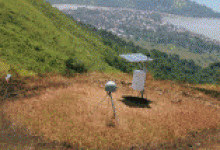
topografipadangdandas

No Image atribute Value
1 Title: topografipadangdandas
2 Upload by: Ibnu Rusydy
3 Upload date: December 10, 2012
4 Image link: https://i0.wp.com/www.ibnurusydy.com/wp-content/uploads/2012/07/topografipadangdandas.jpg?fit=504%2C340&ssl=1
5 Location: 2012/07/topografipadangdandas.jpg
6 Width: 504 px
7 Height: 504 px
8 Description:
Rate this article!
topografipadangdandas,0 / 5 ( 0votes )

Random attachment in topografipadangdandas

Kapal-pengambilan-sampel-laut
A road is seen severed, after a powerful earthquake in Kurihara, in Miyagi prefecture (state), northern Japan, Saturday, June 14, 2008. The 7.0-magnitude earthquake rocked rural areas of northern Japan on Saturday, killing at least two people, triggering landslides and reportedly knocking down a bridge. News reports said dozens of people were injured. (AP Photo/Kyodo News) ** JAPAN OUT MANDATORY CREDIT FOR COMMERCIAL USE ONLY IN NORTH AMERICA **
Display seismic sections with inversion results
tip gempa bumi 3

Leave a Reply